Croeso, Bienvenue, Willkommen, Benvenuto, Welcome
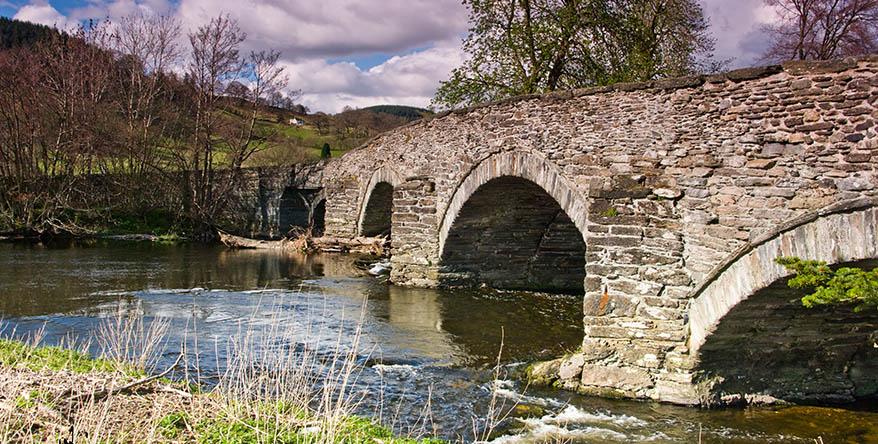
Bala is an historic market town in the Snowdonia National Park, Wales. It is surrounded by the rural region of Penllyn which has a strong and vibrant Welsh identity and culture. It is a wild area of high mountains, deep valleys, forests, fast flowing rivers, waterfalls, and many lakes and reservoirs.
Penllyn’s main mountain ranges - Aran, Arenig and Berwyn – rival those of other parts of Snowdonia but are not as crowded, enabling you to enjoy a wild and serene experience. Hundreds of miles of footpaths and bridleways give access to remote and spectacular places.
The area is alive with rivers, tumbling off the mountains to create great bodies of water. The Tryweryn and Dee flow either side of Bala, creating Llyn Tegid (Bala Lake) – Wales’ largest natural lake. Whether it’s sailing, canoeing, wild swimming or trout fishing you’ll find a place here.
For road cyclists there are many epic tarmac rides to be had over high mountain passes, including Bwlch y Groes (1,800ft/545m). For mountain bikers there is challenging riding straight out of the door, but you are also within an easy drive of some of the world’s best mountain bike trail centres and downhill courses – all of which can be ridden year round. For anyone with a cross or gravel bike Bala’s your lobster…
In 2017, Lonely Planet named North Wales as one of the world’s best regions to visit. Bala & Penllyn is a perfect location from which to explore its many attractions, including beaches, nature reserves, bird sanctuaries, gardens, castles, mines, museums, heritage railways and so much more.
You will hear Welsh widely spoken in Penllyn. For most local people it is our first language and the area has been and remains a stronghold for the Welsh language. It is important to remember that people were speaking Welsh here thousands of years before you even thought of entering the pub!
Whether it’s adrenaline or serenity, diving into a lake or summiting a peak there is something for everyone here and you will find a friendly welcome. Even people who have lived here all their lives’ still stop and wonder at the beauty of the landscape. We hope you will come and experience it for yourself.